Roadmap: Real Sense Application
The RealSense application is a solo project combined many different components I created during my job in the road surveying company
As the idea of the project is to let colleagues can measure objects such as road width, sidewalk, and even cracks.
Since the implementation can't simply program through it, this project has:
Hardware selection, Computer Vision, Location Service, Depth Camera Library, GUI visualization
Further development with
ArcGIS/QGIS plugin creation, Flask web-framework
The first part of the selection of hardware is getting the information of the products from the last years fair
The presentation slides are here
After the comparison of price/ development the final decision is the Intel D435 camera
The key features I designed:
Automation of photo shooting ( every 15 meters as default and changeable)
Live map with location and records:
Using Google Earth/QGIS live update csv written by my script, showing the driver where should be recorded and where is recorded
 Using PyQT creating a tool for
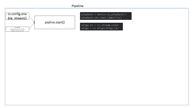
Export JPEG, match frame records (match depth and color)
In ArcGIS import the Photos to points and it can be viewed
Using hyperlink with script excute .exe, the measure plugin can be used universal
start with fast video mode showing only color frame
measure mode will require matching frames, so takes longer while using
The bundle is on GitHub
I used tensorflow and transfer learning to classify the pavements
as in the previous video, the points are classified to: pavement, tiles, pebbles, grass four different types
Export csv file and join back in ArcGIS

GitHub
Using the trained model of ImageAI, I can use computer vision and blur the people and car license within the photos

GitHub
This part is the preparation, after deployment of data on ArcGIS Online, Webapp design and Comment collection is also my projects further
Link to BlogPost
As the idea of the project is to let colleagues can measure objects such as road width, sidewalk, and even cracks.
Since the implementation can't simply program through it, this project has:
Hardware selection, Computer Vision, Location Service, Depth Camera Library, GUI visualization
Further development with
ArcGIS/QGIS plugin creation, Flask web-framework
The first part of the selection of hardware is getting the information of the products from the last years fair
The presentation slides are here
After the comparison of price/ development the final decision is the Intel D435 camera
Collection
The camera is a developer product and the prototype running video:The key features I designed:
Automation of photo shooting ( every 15 meters as default and changeable)
Live map with location and records:
Using Google Earth/QGIS live update csv written by my script, showing the driver where should be recorded and where is recorded
App with Tablet
The latest development is using tablet instead of the laptop in the video
Using Flask app and REST API to control the camera with image, gps location and camera status showing.
An Iphone Version of HTML5 + CSS
Data Preparation

Export JPEG, match frame records (match depth and color)
In ArcGIS import the Photos to points and it can be viewed
GIS usage
start with fast video mode showing only color frame
measure mode will require matching frames, so takes longer while using
The bundle is on GitHub
Image Classification
With every project over 10,000 photos, to reduce colleagues' time browsing through all the photosI used tensorflow and transfer learning to classify the pavements
as in the previous video, the points are classified to: pavement, tiles, pebbles, grass four different types
Export csv file and join back in ArcGIS

GitHub
Image Blur
One requirement for deploying the photos to public is privacy.Using the trained model of ImageAI, I can use computer vision and blur the people and car license within the photos

GitHub
This part is the preparation, after deployment of data on ArcGIS Online, Webapp design and Comment collection is also my projects further
Link to BlogPost


Comments
Post a Comment